


8-day route Santiago - San Pedro
Cost data is updated weekly with AI, as is other relevant information; content validation is manual.
- 8 days
- 23 places
Santiago, Valparaíso and the Atacama Desert in an eight-day route: the mountains, the Pacific, the salt flats and the geysers, without trying to see the whole country.
Some links are affiliate links: if you book through them the site earns a commission, and it costs you nothing extra.
Chile can't be travelled end to end in a week: it is more than 4,000 kilometres from north to south. This route doesn't try. It keeps two faces of the country that hardly resemble each other: the central zone, with Santiago at the foot of the Andes and Valparaíso facing the Pacific, and the Atacama Desert, with salt flats, high-altitude lagoons and geysers.
Why 8 days and not 7?
Because the interesting things are far apart. With seven days you would have to take a day away from Atacama, and the Atacama altiplano is left for after two days in the low desert, not for the day of arrival. How altitude sits with you is a doctor's call before you travel, not this route's.
The eighth day gives the trip its order: Santiago, the coast, the low desert, the altiplano and back to Santiago. And it leaves the last night in the capital, with a margin if the flight from Calama is delayed before an international flight.
Which day of the week to start
Start on a Wednesday, Thursday, Friday or Saturday. Three things on the route trip over Monday, and the calendar lines them up like this: Transvip's shared transfer from San Pedro to the airport publishes no Monday departure (confirm with the company), La Sebastiana is not open on Mondays and neither is the cable car on Cerro San Cristóbal.
If you start on a Tuesday, day 7 falls on a Monday: the transfer publishes no departure that day, and any other way of reaching Calama airport has to be arranged on your own. If you start on a Sunday, the Neruda house on day 2 falls on a Monday. If you start on a Monday, the first day loses the cable car, and the funicular does not run on the first Monday of each month either. With a rental car, the Monday on day 7 stops being a problem, but the rest stays the same.
Cerro San Cristóbal and the time of day
Both ways up the hill close in the afternoon, and in summer the sun sets later. Go up in daylight, and don't plan the afternoon around sunset.
Book this trip
Hotels in Lastarria and Providencia
Stay22 · Booking.com, Expedia and others
Walkable neighborhoods, close to the Metro and to Santa Lucía and San Cristóbal hills.
Cars at Santiago airport
Discover Cars
For a day trip to the coast or the Cajón del Maipo. Compare companies and coverage.
Cars at Calama airport
Discover Cars
Pick up on landing, about 100 km from San Pedro. Compare companies and coverage.
Hotels in San Pedro de Atacama
Stay22 · Booking.com, Expedia and others
The town is the base for excursions to the salt flat, the lagoons and El Tatio.
Day 1
Santiago, the city among the Andes
The first day is done on foot and by Metro, without a car: the historic centre in the morning, the hills in the afternoon and the whole city from above while the ways up the hill are still running.

Sernatur Stop 1
Palacio de La Moneda
The seat of the government of Chile, in the historic centre. In front of it opens the Plaza de la Constitución.
La Moneda · Line 1

Sernatur Stop 2
Plaza de Armas
The city's founding square, with the Metropolitan Cathedral on one side. From La Moneda it is reached on foot along Paseo Bandera.
10 min from La Moneda

Sernatur Stop 3
Cerro Santa Lucía
A hill right in the centre, with stairways, terraces and the Neptune Fountain. From the top you see the centre of Santiago.
Santa Lucía · Line 1

Sernatur Stop 4
Lastarria neighbourhood
Short streets with cafés, bookshops and the Museo de Bellas Artes a few blocks away.
Universidad Católica · Line 1

Santiago seen from above, with the Andes closing the horizon. · Sernatur Stop 5
Cerro San Cristóbal
The city's viewpoint: Santiago below and the Andes range behind. Both ways up close in the afternoon and in summer the sun sets later, so go up in daylight and don't count on being at the top at sunset.
You go up by funicular from Pío Nono or by cable car through the Pedro de Valdivia Norte entrance. Confirm the hours on the Parque Metropolitano website.


- Getting around
- On foot and by Metro. Cerro San Cristóbal is reached by funicular or cable car.
- Where to sleep
- Santiago, in Lastarria, Providencia or near a Metro station
Book for this day
Hotels in Lastarria and Providencia
Stay22 · Booking.com, Expedia and others
Walkable neighborhoods, close to the Metro and to Santa Lucía and San Cristóbal hills.


Day 2
Valparaíso, from the valley to the Pacific
A round-trip day to the coast. In Valparaíso you don't need a car: you walk and take the funiculars.

Carolina Olmedo Carrasco, CC BY-SA 3.0 Stop 1
Muelle Prat and Plaza Sotomayor
The port at sea level: the boat pier and the square with the Monument to the Heroes of Iquique. From here you start climbing the hills.
Terminal Alameda

Joaquin Abarca, CC BY-SA 4.0 Stop 2
Reina Victoria funicular
One of the historic funiculars that climb from the flat part of town to the hills. This one reaches Cerro Concepción.
Their condition changes without notice and the lists of which are working are not official.

Sernatur Stop 3
Cerros Alegre and Concepción
Coloured houses, murals and viewpoints such as Paseo Gervasoni. This is the area for walking without a fixed direction.
Steep, cobbled streets: comfortable shoes.

Alexxxos, CC BY-SA 3.0 Stop 4
Paseo 21 de Mayo
A viewpoint on Cerro Artillería with the whole bay and port in sight.

Mikel Santamaria, CC BY-SA 2.0 Stop 5
La Sebastiana
Pablo Neruda's house on Cerro Florida, turned into a museum, with a view over the bay.
With an entrance fee; check the hours on the Fundación Pablo Neruda website.


- Getting around
- Bus from the Alameda Terminal in Santiago. In Valparaíso, on foot and by funicular; which ones run changes without notice, so confirm that day which are working. If you prefer to drive, a compact car for just the day is enough: Route 68 is paved.
- Where to sleep
- Santiago
Book for this day
Cars at Santiago airport
Discover Cars
For a day trip to the coast or the Cajón del Maipo. Compare companies and coverage.


Day 3
From the centre to the desert
A transfer day, with a single outing at the end: the Valle de la Luna, if your arrival leaves some margin before the last entry. If not, it moves to the free morning of day 7, depending on the time of your return flight. Today you go no higher than the town: the altiplano comes later.
Stop 1
Santiago–Calama flight
A flight crosses the country to the north. From Calama airport it is about 100 km to San Pedro de Atacama.
There are shared transfers from the airport; book in advance.
Stop 2
San Pedro de Atacama village
Adobe streets around the square and the church. It is the base for all the excursions of the coming days.
San Pedro is at altitude. If you are unsure how you will cope, see a doctor before you travel.

Diego Delso, CC BY-SA 4.0 Stop 3
Valle de la Luna
Dunes, salt and rock formations a few kilometres from the town. You enter by car, motorbike or bicycle, or with an authorised tour, and never on foot. The bicycle has a shorter entry window than the car.
The ticket is bought online a day ahead. The hours change with the season and there are Tuesday closures: confirm when you buy.
- Getting around
- Flight to Calama and about 100 km by road to San Pedro, by transfer or in a car rented at the airport. From here on the car is worthwhile: the excursions of the coming days all leave from the town.
- Where to sleep
- San Pedro de Atacama
Book for this day
Cars at Calama airport
Discover Cars
Pick up on landing, about 100 km from San Pedro. Compare companies and coverage.
Hotels in San Pedro de Atacama
Stay22 · Booking.com, Expedia and others
The town is the base for excursions to the salt flat, the lagoons and El Tatio.


Day 4
Salar de Atacama and Laguna Chaxa
A day on the salt flat, still lower than the altiplano, with a single stop that requires a ticket bought online before you leave. The rest of the day is free: it is the margin if the Valle de la Luna did not fit on day 3, or the day for Laguna Cejar, which sells a single ticket for its two lagoons, with an assigned day and time.

Sernatur Laguna Chaxa
A shallow lagoon in the Salar de Atacama, inside the Los Flamencos National Reserve, run by the Toconao community. People come to watch flamingos.
The ticket is bought online before going. Hours change because of weather or community activities.

- Getting around
- By your own car or on a tour from San Pedro.
- Where to sleep
- San Pedro de Atacama


Day 5
Altiplano lagoons and Piedras Rojas
The highest day of the route, which is why it comes after the two days in the low desert. Before leaving, the lagoon tickets are bought online and validated in Socaire.
Stop 1
Socaire
A village on the road to the altiplano, run by the Comunidad Atacameña de Socaire. The mandatory registration for Miscanti and Miñiques is done here.
Bring the ticket's QR code and the vehicle's licence plate.
Stop 2
Lagunas Miscanti and Miñiques
Two high-altitude lagoons inside the Los Flamencos National Reserve.
The ticket is sold online only; it is not sold at the lagoons. Before going up you must register in Socaire with the QR code and the vehicle's licence plate, and places are opened each day depending on the weather.
Stop 3
Piedras Rojas
A sector of the Salar de Aguas Calientes Sur, on the altiplano, run by the Atacameño Community of Socaire.
According to the community, vehicles do not enter the salt flat and it is covered on foot, about 3 km in all: ask when you buy the ticket, which is online.
- Getting around
- Tour or your own car, across the altiplano. The nearest fuel is in San Pedro: leave with a full tank. Check road conditions before setting out.
- Where to sleep
- San Pedro de Atacama


Day 6
Tatio geysers and a night of stars
You get up early to arrive with the first light, return to the town in the morning and leave the night for looking at the sky. El Tatio does not admit children under 9 or pregnant women: with them, this day is not done. The night of stars depends on the moon, so check the lunar calendar before fixing your dates.

Steam rising from the ground at the Tatio geysers, 4,320 metres up, at dawn. · Diego Delso, CC BY-SA 4.0 Stop 1
Tatio geysers
A geyser field on the altiplano. The steam rises higher in the cold of dawn.
Pre-dawn departure. Children under 9 and pregnant women are not admitted, and the visit is not recommended for people over 70. Warm clothing.
Stop 2
Astronomical tour
There are tours with telescopes near the town. At least one of the operators does not run observation during the seven nights around the full moon.
Fix this night outside those seven days: with a full moon that tour does not run, and booking it without looking at the lunar calendar can leave you without a night of stars.

- Getting around
- The usual thing is a pre-dawn tour from the town.
- Where to sleep
- San Pedro de Atacama





Day 7
A slow morning and return to Santiago
Return to the capital with a day of margin: the domestic flight is not right up against the international one. Confirm with Transvip which days the transfer runs before fixing your flight time.
Stop 1
Free morning in San Pedro
A morning without an early start, to walk the town or, Monday to Friday, to visit the Aldea de Tulor, which is booked by email at comdecoyo@yahoo.com, with guides from the Coyo community.
Leave time for the transfer to Calama airport.
Stop 2
Calama–Santiago flight
Transfer back to Calama airport and flight to Santiago.
- Getting around
- Transfer or car to Calama airport; if you rented, it is returned there.
- Where to sleep
- Santiago
Book for this day
Hotels in Lastarria and Providencia
Stay22 · Booking.com, Expedia and others
Walkable neighborhoods, close to the Metro and to Santa Lucía and San Cristóbal hills.
Day 8
One last look at Santiago
The last day is left for what was missed in the centre and for getting to the airport without hurry.

Sernatur Stop 1
Mercado Central
A fish and seafood market under a nineteenth-century iron structure. A good place for a last lunch.
Puente Cal y Canto

Sernatur Stop 2
Museo Nacional de Bellas Artes
The museum is in the Parque Forestal.
Check hours and closing days on the museum's website.


- Getting around
- On foot and by Metro. To the airport, bus or transfer from the centre.


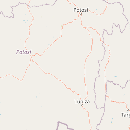
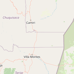
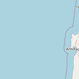
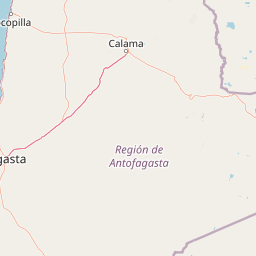
Map




















More about Chile
See all the guides
Torres del Paine in One Day
A full day in Torres del Paine from Puerto Natales: the public bus with two variants, the full-day van and your own car, and why Base Torres does not fit.
Long weekend Santiago - Valparaíso
Four days between the capital and the port: downtown Santiago, the hills of Valparaíso and the coast of Viña del Mar, all within a radius of 120 kilometres.

5-day route Iquique - San Pedro
From Iquique to San Pedro in five days, climbing from the coast to the desert: the nitrate works, Paranal Saturday and two long bus stretches counted for what they are.

4-day route through Easter Island
Four days on Rapa Nui: the Tongariki moai at dawn, the Rano Raraku quarry, the ceremonial village of Orongo and Anakena beach.

5-day route Arica - Parinacota
From Arica to Putre, Lauca and Surire in five days, ordered by altitude: low first, and the night in Putre before any park.
6-day route to Torres del Paine (W)
Six days in Torres del Paine National Park from Puerto Natales: three days hiking the W circuit, the Grey glacier and an optional detour to the Milodón Cave.

4-day route La Serena - Elqui
La Serena, Vicuña and Pisco Elqui in four days, built around the Saturday at Cerro Tololo and the observatory nights, which are booked before leaving.


