


5-day route Arica - Parinacota
Cost data is updated weekly with AI, as is other relevant information; content validation is manual.
- 5 days
- 12 places
From Arica to Putre, Lauca and Surire in five days, ordered by altitude: low first, and the night in Putre before any park.
This route is ordered by altitude, not by distance. Arica is at sea level and Putre at 3,500 m; Lauca, Las Vicuñas and Surire sit above 4,000. That is why the four nights are Arica, Putre, Putre and Putre, and why no day climbs to a park from the coast in a single outing. What to bring for the altitude is for your doctor to decide, before you buy the ticket.
What to book before leaving
The two excursions with a Putre agency, the Cotacotani trek and the Surire tour, have a minimum and a maximum number of passengers: if you travel alone, ask whether a group already exists for your date before fixing it. The road to Surire, moreover, is only passable at certain times of year, so the agency is the one who tells you whether that day is possible.
Rent the car in Arica, not in Putre. There is no fuel station on the road or inside the parks.
A calendar warning
In summer the altiplano rains arrive, and lightning on the Lauca trails, from December to March. Once, in February, Lauca, Las Vicuñas and Surire were closed at the same time, with people stranded on the roads. If you travel in those months, leave a spare day at the end and check the forecast before going up.
Where the days fall
Lauca does not open every day, and neither do the Arica museums. Build the week so that day 3 and the museums of days 1 and 2 do not land on the closing day; day 4 and day 5 tolerate it better.
Day 1
Arica, the bottom step
The day below, before climbing. Colón 10 is in the centre and is done on foot; the Morro is reached by taxi or colectivo, so there is no need to rent a car yet. If you land early, you have an afternoon to spare; if not, the Morro alone already fills the afternoon.
Stop 1
Museo Histórico y de Armas del Morro de Arica
The top of the Morro, with the bay below and a history and weapons museum. It is the view that organises the city before you leave it.
Camino al Morro s/n. Opens on public holidays, unlike the other two museums.
Stop 2
Museo de Sitio Colón 10
A site museum right in the centre, reached on foot from the historic quarter.
Run by the Universidad de Tarapacá. It closes one day a week: check which one before fixing the day.
- Getting around
- On foot through the centre; taxi or colectivo to the Morro. From the airport to the centre, taxi or transfer.
- Where to sleep
- Arica, near the centre so you can get around on foot


Day 2
Azapa Valley and the climb to Putre
A day in two parts: the morning below, in the valley, and the afternoon climbing along route 11-CH to the east. This is the first time the road gains altitude, and that is why the day ends in Putre and not higher up. Fill the tank in Arica before leaving. The Quebrada de Cardones, on the way, has no visitor service and only receives scheduled groups: it does not count as a stop.
Stop 1
Museo Arqueológico San Miguel de Azapa
The region's archaeological museum, in the Azapa valley. It is done before climbing, with the car still down below.
Azapa Valley, km 12 from the centre. It closes one day a week: check which one before fixing the day.
Stop 2
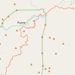
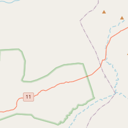
Route 11-CH, from Arica to Putre
The climb from sea level to 3,500 m along a single road, the 11-CH, heading east. It is the stretch that justifies sleeping in Putre and not going on.
It is 149 km. No fuel station on the road.
Stop 3
Town of Putre
The town where you sleep before climbing. This afternoon is about arriving, walking around it and booking the next day's activity.
The tours for days 3 and 4 are confirmed here.
- Getting around
- Rental car from Arica. Without a car, there are buses between Arica and Putre but they do not leave every day: confirm days and times at the Arica terminal, and count on the Putre agencies for the rest.
- Where to sleep
- Putre, at 3,500 m: the first night up high


Day 3
Lauca, the first day above 4,000 m
The day you sleep in Putre for, and the first above 4,000 m. The trails are short: the lagoons first, the lake after and the village of Parinacota at the end. Without a car, the Cotacotani trek with an agency is the way into the park. Getting to Chungará and Parinacota requires your own vehicle or a tour that includes them: ask what your agency does that day.

Sernatur Stop 1
Cotacotani Lagoons
A group of lagoons at 4,350 m, inside Lauca, covered on foot with a Putre agency.
Trek with a Putre agency. It has a minimum and a maximum number of passengers: book before going up.

Sernatur Stop 2
Lago Chungará
The lake at 4,500 m. The trail is 600 m long and takes half an hour.
There is no fuel station inside Lauca.
Stop 3
Parinacota village and trail
The village of Parinacota and its church, and a 3.2 km trail that takes a couple of hours. The village is uninhabited for most of the year and the church may be closed.
The church celebrates the feast of its patron saint, Santiago; confirm the date before building the day around it.

- Getting around
- With the Putre agency to the Cotacotani trek; own car inside the park, with no fuel stations on any stretch. Pets, drones and fire are not allowed.
- Where to sleep
- Putre


Day 4
Surire, the day of the dirt roads
A whole day away from Putre, on dirt roads. Four-wheel-drive vehicles or the agency reach Surire; the road is in poor condition and is only passable at certain times of year, so this is the day that falls through first if the weather or the road condition worsens. Las Vicuñas, the other reserve, also has no public transport. With your own car you enter by the A-235, which leaves the 11-CH, and a high-clearance vehicle is recommended. The tour needs a group, so ask the agency on day two whether people are already signed up for your date. Finding out on day four leaves the day with nothing arranged.

Sernatur Stop 1
Salar de Surire
A salt flat at 4,245 m, inside a natural monument with no trails: only the main road is travelled.
No public transport.
Stop 2
Guallatire and the Polloquere hot springs
The village of Guallatire and the Polloquere hot springs, which are part of the same tour. Next to the springs there is a camping area.
Included in the Surire tour.

- Getting around
- Shared tour with a Putre agency, which picks you up at the hotel. With your own car it is only reachable with four-wheel drive.
- Where to sleep
- Putre


Day 5
Down to Arica and a flight to Santiago
The way-back day, from 3,500 m to sea level along the same route 11-CH. The flight rules: do not put it early, because you have to come down first and return the car in Arica. A late flight absorbs a slow departure; if the road to Surire closes the day before, what is needed is one more night and not this day.
Stop 1
From Putre to Arica along route 11-CH
The same road as the climb, now going down. No fuel station until Arica, so leave Putre with a full tank.
149 km. It passes through the Quebrada de Cardones, which is not a stop.
Stop 2
Chacalluta Airport
Arica's airport, 18 km from the centre, with a direct flight to Santiago.
Return the rental car before going in.
- Getting around
- Own car back to Arica. Return it before the airport. Without a car, the same bus back to Arica, with the days and time already confirmed, and a taxi to Chacalluta.
- Where to sleep
- Return flight to Santiago


Map


More about Chile
See all the guides
Torres del Paine in One Day
A full day in Torres del Paine from Puerto Natales: the public bus with two variants, the full-day van and your own car, and why Base Torres does not fit.

Long weekend Santiago - Valparaíso
Four days between the capital and the port: downtown Santiago, the hills of Valparaíso and the coast of Viña del Mar, all within a radius of 120 kilometres.

8-day route Santiago - San Pedro
Santiago, Valparaíso and the Atacama Desert in an eight-day route: the mountains, the Pacific, the salt flats and the geysers, without trying to see the whole country.

5-day route Iquique - San Pedro
From Iquique to San Pedro in five days, climbing from the coast to the desert: the nitrate works, Paranal Saturday and two long bus stretches counted for what they are.

4-day route through Easter Island
Four days on Rapa Nui: the Tongariki moai at dawn, the Rano Raraku quarry, the ceremonial village of Orongo and Anakena beach.
6-day route to Torres del Paine (W)
Six days in Torres del Paine National Park from Puerto Natales: three days hiking the W circuit, the Grey glacier and an optional detour to the Milodón Cave.

4-day route La Serena - Elqui
La Serena, Vicuña and Pisco Elqui in four days, built around the Saturday at Cerro Tololo and the observatory nights, which are booked before leaving.


